Saturday, December 14, 2013

The Far North

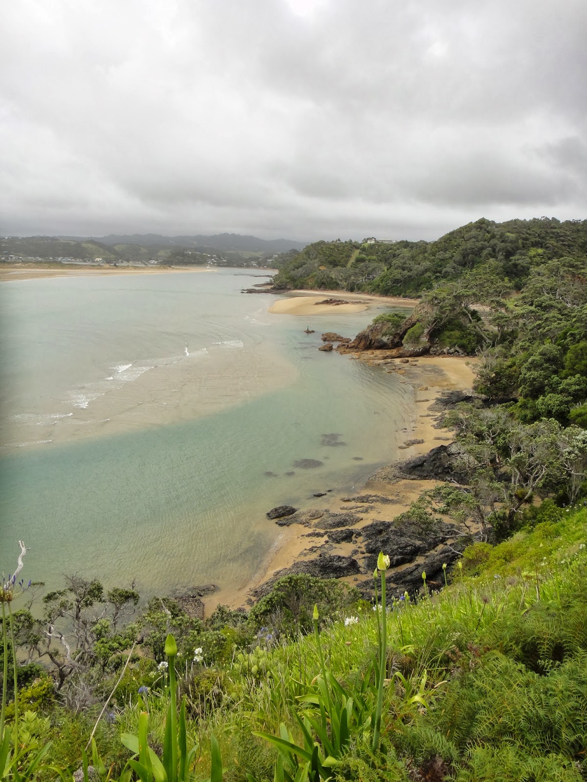
After all the hiking we had done the day before, we needed some time to recoup.  Enter Maitai Bay.  At the end of the remote Karikari Peninsula, a sacred Maori headland divides two bays.  The northern of the two is Maitai Bay, and it just so happens that the DOC operates a highly revered campsite just beyond it's shores.  Short of providing actual Maitais, the site provided everything we needed to recharge our batteries.  You could hear the waves crashing on the beach from our campsite!  To wrap up the day, we dined at the "World Famous Mangonui Fish Shop" which supposedly does the best fish and chips in all of New Zealand.  While our experience is limited, it was surely the best we've had.  After I awoke the next morning it became apparent that I'd had a run in with the infamous New Zealand sandflies while lying on the beach (and maybe a few mosquitos too).  Guess no place is perfect.  

Maitai Bay
Fish and Chips

and bug bites!
At this point, our time in the Northlands was coming to an end, with the northern most part of the Northlands, and indeed New Zealand a two hour drive from the campsite.  We arrived in Cape Reinga mid afternoon and took a stroll to the lighthouse where they had one of those tacky-but-fun signs that showed the distance to various cities around the globe  (10,479 km to Los Angleles!).  Cape Reinga is one of the most important spiritual sites for the Maori people, as it is believed that when they die, their spirit leaves NZ for the ancestral homeland of Hawaiki by way of the beach at Cape Reinga.  Another interesting geographical phenomenon is that Cape Reinga is where the Tasman Sea meets the Pacific Ocean, and the clashing currents of the two waters actually creates whirlpools that you can see from the shore!

The lighthouse at Cape Reinga 
The whirlpools formed by the currents of the Tasman Sea meeting with the currents from the Pacific Ocean
Lands End, the departure point of souls to Hawaiki.
At last it was time to turn back and head south, our time in the Northlands had turned it's corner.  But there was one more stop to make near the northern tip of NZ.  On the northern edge of 90 Mile Beach there exists giant sand dunes the likes of which no man has ever seen before…Ok, maybe I got a little carried away with that.  But they are pretty awesome!

We stumbled through a wormhole and ended up in Saudi Arabia!

Luckily for us, there was a van in the carpark renting boogie boards and after struggling to climb up, we boogied and boarded our way down the massive dunes at breakneck speeds.  Sweet as!  

Tons o fun!


Friday, December 13, 2013

Two Summits, One Day

We hit the road early the following day as there was a bit of distance that needed to be covered if we were to hit our next campsite for the night.  The road we were taking is known as million dollar view road, so of course we made a few obligatory stopovers at some beautiful bays despite any sort of schedule we were trying to keep.  I'll let you sneak a few peaks at those beaches below, but today I'm here to talk to you about tramping.  You see, the million dollar view road ends in a largely undeveloped harbor called Whangaroa Harbor.  There is a (very) small town where deep sea fisherman come to try their luck with the marlin, but we weren't there to fish.  No, today we were going tramping.

Here are your photos of the bays: Matauri Bay


and…Tauranga Bay? They're getting hard to keep track of. 

The first trail we did was a warm up for the second.  Named St Paul's Rock, and commanding 360 degree views of the harbor and it's surrounds, after Velma got us to the trailhead (and admittedly did half of the work for us) we were on the summit the rocky hill in less than 30 minutes taking in those views.


The second trail was longer, more challenging and more rewarding.  It is one of the only walking trails that snake's its way into the heart of the Whangaroa Harbor.  I had been looking forward to this trail ever since I'd seen the photos in our travel book NZ Frenzy.  This was to be  the first serious tramp since leaving Auckland.  After finding the trailhead, we geared up and headed out.  The trail first climbs up to a ridge by means of an old unused dirt road before descending through dense coastal lowland forests on other side.  The trail then emerges onto a flat river valley and follows the stream to it's mouth at Lane Cove where it climbs steeply to the top of a rocky outcropping called the Duke's Nose.

We were admittedly a bit tired from the St Paul's hike, so the initial ascent of the ridge was something of a thorn in our side (or was that a cramp?).  When we got to the first river crossing at the end of the descent things started getting good.  Along the bank of the river are thick mangroves, and beyond those grassy meadows before the hills carpeted with forest climb steeply to the base of the towering black rock walls the border the valley.  As we proceeded through the valley, we even managed to see an airy waterfall coming over the side of one of the walls.  It reminded me of Yosemite, if only on a smaller scale.

The valley
Do you see the waterfall?
Once we reached Lane Cove, all that remained between us and a spectacular view was the 20 minute trail that scales the Duke's Nose.  Those final 20 minutes made both the ridge ascent and St Paul's rock feel like the rolling plains of Kansas.  We huffed and puffed grabbed onto every tree root we could to crawl up the near vertical hill before reaching the rock itself.  From there, chains were graciously provided to pull yourself up the remaining hundred feet or so.  Then we got to the top.  Whoa! 

Lane Cove
Couldn't you see this landscape being in the next Avatar?

All is worth it
Unfortunately we didn't get to spend much time with the view, since sunset was rapidly approaching and we had a two hour hike back to the car.  I get the feeling that even if we had had hours to pass at the top of the Duke's Nose, the view is so spectacular that regardless how long you stare it would still be heartbreaking to peel yourself away from it.  Best hike in New Zealand yet.  

Wednesday, December 11, 2013

The Cream Trip

With the second day on the Bay of Islands full of sunshine, we thought it time to do what we came here to - the Cream Trip.  If you hadn't noticed by the name, the Bay of Islands is a bay full of islands (144 if I'm not mistaken).  The special thing about these islands is that these days they are largely undeveloped and publicly owned with a few exceptions.  This wasn't always the case, and thus the Cream Trip was created. The Cream Trip is an old boating route launched launched in 1886 with the purpose of delivering coal products to the inhabitants of the islands and transporting cream from the islands farms.  In the 1920's Fuller acquired this route and with rise of the Bay of Islands as a tourism destination in the 1980's, they began selling tickets to the public to allow tourists the access the beauty of the greater bay and it's islands.  Of course, now a days they include things like island stopovers, swimming with dolphins, and going through the Hole in the Rock to the trip and they are delivering mail instead of coal supplies.  

We boarded the boat and set sail around 9:15 am, and after making a quick stop at Russell to pick up a few more passenger the trip official began as we made our way towards the Moturoa Island for the first delivery.  The tour was accompanied by the captains narrative, which filled us in on the historic significance of various sights we visited as well as pointing out the natural features and creatures inhabiting the areas.  It was via this commentary that we learned Moturoa Island is one of only two islands in the bay that is privately owned.  It is owned by some 120 lucky (and probably exceedingly wealthy) shareholders, many of whom have built holiday baches on the island.  


After the first delivery and a brief tour of the area surrounding the island, we hit the open water for the chance to spot some dolphins.  It wasn't long before we happened upon a large pod of 30-40 dolphins frolicking about, although we were informed that since this pod contained baby dolphins we wouldn't be able to snorkel with them.  Either way, watching the playful dolphins peruse around the boat, showing off their tricks and poking around curiously was highly entertaining.  The captain mentioned many interesting facts about the animals, such as that they are the only animals in the animal kingdom besides humans who have sex not solely for means of reproduction (an activity which, he added, they were gratuitously indulging in as he spoke).  He also mentioned that New Zealand keeps no dolphins in captivity, as the life expectancy for caged dolphins drops considerably.  Right on New Zealand!


The next three islands were the cream of the trip (see what I did there? :p).  We did a drive by of Moturua Island, not to be confused with the before mentioned MoturOa.  Gotta love those Maori names.  The island was an absolute beauty.  An Auckland millionaire had built a veritable complex on the only privately owned portion of the island, and the beach he fronted was arguably one of the most scenic in the world.  Luckily for the rest of the world, due to the New Zealand law that all beaches must be public access and therefore cannot be privately owned, anyone with a boat can mosey on up and enjoy it for themselves. 


Motuarohia island, which is the island neighboring Moturua Island to the west, was equally if not more stunning.  Sporting two lagoons on the single narrow sand spit connecting two larger forested hills, whoever owns the single modest bach on this island is truly one to be envious of.  It is most certainly another contender for most beautiful island/beach in the world.  


The last island that we got to check out was Urupukapuka Island.  This island is the largest in the bay and our experience with it was unique from the rest in that we actually got to dock and explore the island.  The island is completely owned by the New Zealand Department of Conservation and it runs several camp sites on the island, provided you can hire a water taxi or charter boat to get there.  We docked into Otehei Bay and were released from the ship to go about our whims for about an hour or so.  Otehei Bay is another drop dead gorgeous stunner.  The water is clear as glass and we saw several large fish swimming under the docks.  An American writer by the name of Zane Grey established a base in the bay for a time so that he could beat other deep sea fishers to the waters in the morning.  After a short swim I ran to the top of the tallest hill I could find for a wonderful panoramic of the whole island and it's many lovely bays.


The final stop for the day was the Hole in the Rock, which is exactly what it sounds like - a hole in a large rock just off the coast of Cape Brett.  Once the boat started moving towards the more open waters near the rock, the sea became pretty rough and numerous people on the ship had to rush for their little white bags.  Fortunately neither Kayleigh or I are prone to sea sickness, but due to the conditions of the sea, we were prevented from the privilege of sailing through the hole.  That didn't make the views any less amazing.


I know this has been a long post, but it was a day full of stories that need to be told, and the last thing I'd like to share with you is that on our return towards Russell, we were surprised by a pair of dolphins doing some tricks out in front of the boat.  It's apparently very rare to see only a pair of dolphins with no pod around, and many took the opportunity to jump into the water for a snorkel with the playful pair.  Kayleigh and I held back on this one, as it wasn't very long before other tourist boats in the area spotted our luck and came to get a piece of the action.  Before we knew it, there was over 5 boats unleashing a snorkel army onto the unsuspecting dolphins, who unsurprisingly turned and swam for the hills.  


The Cream Trip is a definite highlight of our time in the Northland.    

Tuesday, December 10, 2013

The Bay of Islands

After a long night of feral rain and howling wind, we woke up the next day in Russell to more steely grey sky and the promise of more rain.  Feeling a little disappointed, we hopped on a ferry on drove over to Paihia, the hub of the Bay of Islands.  We had planned on going to check out some waterfalls since the rain would be keeping us out of the water.  In a twist of luck however, the weather forecast turned out to be completely wrong and the sun was brilliantly shining by noon, drying all our soggy dreams of life on the beach.  

Since we were already en route, we decided to stick with the waterfall plan, and the first of the two was Haruru Falls.  Haruru Falls is a short drive out of Paihia and is short but wide fall in a horseshoe shape, and being so close to Paihia it's also the recipient of the lion's share of tourist traffic in the area.  It isn't a particularly breathtaking fall, but given that we viewed it right after so much rain the sheer volume of water coming over the falls was impressive.  


The second falls we visited was Rainbow Falls, located a little outside of the small rural town of Kerikeri.  This falls is pretty much off the tourist trail and we were hoping to have the chance to be able to get into the cave behind the falls, but once we arrived and seen the flood like conditions there was no way to get back there safely.  

No getting back there today!
After lunch we decided to head back over to Russell, since the weather didn't give us a fair chance to check it out.  I'm glad that we did.  Russell is a small town on the Bay of Islands across the water from Paihia that is full of character.  It was once infamously known as the "Hell Hole of the Pacific" as it was one of the first port towns in all of New Zealand and had a variety of colorful business catering primarily to the sailors as they came into port.  Rumor has it that the port town depicted in the first Pirates of the Caribbean movie was modeled after Russell.  These days however, it's a beautiful little old town with a few nice restaurants, bars and hotels situated right on the waterfront.  

The waterfront in Russell

The receptionist working when we checked into our campsite in Russell the night before had recommended to us to check out some of the view points around the city, so Tapeka Point is where we headed next.  The hike was an uphill slog in the sun, but the views…oh the views.  All the way along the trail you are treated to sweeping panoramas of the wonderfully blue bay and forested coastline.  The addition of some well placed bazillion dollar homes made it feel as though you were looking over the Mediterranean coast.  Enough talk…check out the photos!


From the top!

Friday, December 6, 2013

The Tutukaka Coast

After three days of glorious sunshine and high temperatures it all came crashing down.  The skies were gray and unpromising as we left Whangarei for the Tutukaka coast about 30 minutes away, however it did add an interesting atmosphere to the drive. It reminded me of driving around the central coast of California.  We passed many farms and ranches framed with walls of block volcanic rock and lots of green moss and dense woods.  Everything was imbued with a sense of enchantment and mystery by the thick grey mist that obscured the far reaches of the landscape.  The rain held off long enough that we took a short detour over a hill to a big bay and made a short trek to the top of a lookout for a wonderful view of the circular bay and bordering town with it's giant sand bar. 


When we reached the town proper of Tutukaka the sky finally opened and the water began to fall.  We figured it best to find accommodation for the night, and perhaps the weather would clear up and we could resume our beach hopping the following morning.  Little did we know.  We made an attempt to find some sort of entertainment in town for the night, but quickly realized there was none to be found.  The town of Tutukaka consists of one hotel, one restaurant, a wharf, a general store, and a few baches (Kiwi vacation homes) which were empty as far as the eye could tell.  It's mainly used as a hub for scuba diving at the Poor Knight Islands which is apparently one of the world's greatest (secret) dive sites.  

In the morning we hit the road, again to grey misty skies.  But they were dry grey misty skies so far.  We continued our drive along the coastline, stopping at a few bays to take some photos before getting out to do a short hike to Whale Bay.  It was a short walk, but I wasn't prepared for the raw beauty of this little bay.  It's located on a little headland in between two larger bays, and it is completely free of any coastline development.  Once you're on the beach, it's just you, the sand, and the forest for a backdrop.  It was reminiscent of some of the beaches I'd visited in Costa Rica, pure in it's (almost) untouched state.  Sun or no sun, the teal water beckoned me forth.  I waded around in the water on the soft sand for near an hour, gazing back and forth from the sea to the forest behind, listening to the bird song and the sound of the waves simultaneously.  This little bay made me impervious to the grey skies above.


Back on the road again, this time for a longer haul to the small port town of Russell on the Bay of Islands.  This is when all hell broke loose.  The sky became a waterfall as we were battered with wind and monsoon level rain.  It made all further attempts at stopping severely unenjoyable.  We passed many miles of bays and coastal views hidden from view by the torrent from above.  We did receive an example of kiwi kindness, however, while detouring a isolated and mostly undeveloped peninsula an old man offered for us to park in his driveway next to his house for the night so as to better escape the wind and rain, rather than brave the open landscape of the campground.  


Shortly after arriving in Russell we checked into our campground and quickly evacuated the car to the dining facilities on the grounds. In what seemed like mean spirited teasing, when checking into the park they had a tourism video playing in the lobby showing all the amazing views, beaches and activities surrounding the town.  All with cloudless sunny skies.  Luckily all would turn around tomorrow, and that video proved to be more a premonition than a mean joke.  

Wednesday, December 4, 2013

Northland Part I: Uretiti

Batteries charged.  Gear loaded.  Tunes cranked.  Windows down.  We set off from Auckland in a buzz of caffeine soaked excitement.   Our destination was shifted slightly northwards upon the realization that the campsite we had planned on was full, but nothing could diminish our enthusiasm.  We crossed into the Northland for the first time and a wave of relaxation swept over me as the vacation became a reality.  After Velma (the van) gave a good slogging trying to push us and all our gear over the crest of a big hill, a vast expanse of deep blue sea and mountains stretched out before us, adding a new wave of euphoria to our already elated senses.


We pulled over to snap a picture, a monument to this special moment in time, and as we made our way down the other side of the hill, the highway met up with and ran parallel with the beach we had seen from above.  Up ahead, a sign appeared, reading Uretiti Recreational Reserve, just the place we had been looking for.  This was to be our campsite for the next three nights.  Up to this point neither of us had heard of this place before, and we were only staying here because the original first stop had been full up.  For all the planning that I did, sometimes the best things happen by accident.  Such was the first day.

This is the view of the campsite from the highway
A slice of heaven
Uretiti beach is a massive white sand beach on Bream Bay with sand as fine as talcum powder.  The sea is dark blue on the horizon, with turquoise fading to translucent as the waters lap onto the shore.  The whole beach is backdropped by some rugged mountain headlands and a few islands laid out on the horizon.  The only thing separating our campsite from the beach itself was a big white sand dune covered in scrub brush.  The campsite itself has a unique beauty on it's own, with dry, almost desert like foliage contrasted sharply with the evergreen grass and trees right across the highway.  You gotta love the DOC, they really know how to do it right.  After a quick read through the brochure, we learned Uretiti was the largest nude beach in the Northland, with the camp as the north/south dividing line between the clothing and clothing optional portions of the beach.  For a beach with the name Uretiti, what else would one expect?  We stayed safely to the north of camp and never saw a nudey (or much of anyone for that matter)


Using Uretiti as a base, we explored the nearby Piroa Falls.  A fairly short drive and hike brought us there, and after a brief time at the bottom we spotted a trail leading to the top of the falls.  There were a few plunge pools deep enough for a swim, so we stripped down to the bathing suit and jumped in.  There was an awesome pool at the top of the falls being fed by a mini fall that we played around in a for a while before heading back to the car to make our way to the next half of our day trip - Waipu Caves.  Now if you'll recall, we've been to some caves in New Zealand before.  We went to Waitomo to do some backwater rafting and see some glowworms and cave formations.  This cave, however, differed from those in that it is not a commercial tourist attraction, rather just some cave on a nice guy's property at the end of a long dirt road.  That didn't make the glowworm spectacle any less spectacular.  There was a massive display of bioluminescence a short walk into the cave, and what we gave up in terms of comfort (the cave was muddy and slippery with no place to sit) we made up for in having the place to ourselves for a several minutes and it costing nothing.  I would actually recommend these caves as an alternative to Waitomo, for reasons above.  Sometimes the best things in life really are free.  


Caves and cameras don't mix well
...Neither do cameras and glow worms
The next few days we went to explore Whangarei, the largest town in the Northland.  We had to stop by the store to grab some supplies and scout out the movie theater (where we saw the new Hunger Games) and went to Whangarei Falls, which is surprisingly in a reserve within the city limits.  Whangarei is a functioning rural town with a quaint downtown, so we didn't spend much time there as you might imagine.  We did happen to meet a really friendly lady from Ukiah, CA who was running a used bookshop and let us use her parking lot while went to the movies :)


Overall, our first three days were amazing, we had beautiful sunny weather for the most part, and spent plenty of time on the beach.  It was sad to leave the Uretiti camp, but the trip must continue.  It was off to the Tutukaka coast, where the weather would take a turn for the worst.  More on that next time